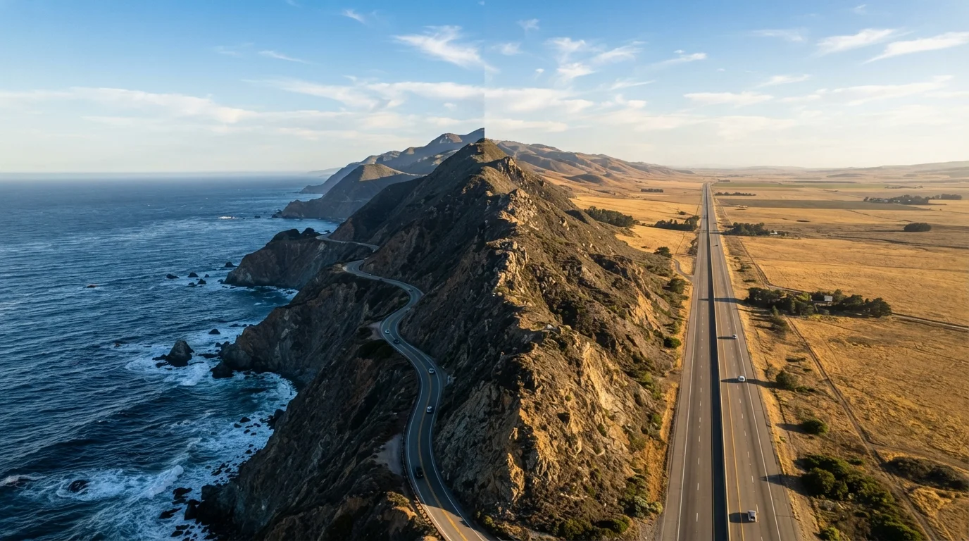
The Core Trade-Off: Scenery vs. Speed
Every cross-country driver eventually faces it: do you chase the ocean or own the miles? The choice between a coastal highway and an inland interstate isn't just about the map — it shapes your daily routine, your fuel budget, your stress levels, and what stories you bring home.
Coastal highways — think California's Highway 1, US-101 through Oregon and Washington, or sections of US-1 along the Atlantic seaboard — wind through dramatic geography that demands your full attention. That's a feature, not a bug, for travelers who want the road to be the experience. But it comes with real costs: average speeds drop considerably on two-lane cliff roads, gas stations can be 40–60 miles apart, and cell service drops out regularly.
Inland interstates — I-10, I-40, I-80, I-90 — are engineering marvels designed for throughput. You'll cross time zones with minimal drama, pass through mid-continent cities with strong service infrastructure, and arrive with a lower fuel bill. The scenery is often underrated, too: the Rockies on I-70, the Texas Hill Country near I-10, and the desert Southwest along I-40 offer genuine grandeur. For a broader look at route types, iconic American road trip routes breaks down what makes each corridor worth considering.
| Criterion | Coastal Highway | Inland Interstate |
|---|---|---|
| Scenery | Ocean views, cliffs, harbor towns | Varied: plains, mountains, desert |
| Average driving speed | 35–55 mph on two-lane sections | 65–80 mph (speed limit dependent) |
| Fuel stop frequency | Irregular; plan carefully | Every 20–40 miles typically |
| Fuel cost | Often higher in coastal/tourist areas | Generally lower, more competitive |
| Accommodation availability | Book well ahead, especially in summer | Walk-in options widely available |
| Cell coverage | Gaps common on remote stretches | Reliable along most corridors |
| Weather/closure risk | Higher — mudslides, fog, storms | Lower, though winter storms occur |
| Family road trip ease | More challenging logistics | Easier with consistent rest stops |
Logistics That Actually Matter
Planning is where most road trips succeed or fail, and the logistical differences between these two route types are significant. On a coastal highway, fuel planning is non-negotiable — don't assume a gas station is just ahead. Coastal towns can be spaced unpredictably, and premium fuel prices in tourist-heavy areas run noticeably higher than interstate averages.
Accommodation follows a similar pattern. Coastal towns book up fast in summer, and walk-in options are limited. On the interstate corridor, chain motels, truck stops with overnight parking, and 24-hour diners appear with clockwork regularity. If you're building your first long-distance itinerary, planning a US road trip from scratch covers the essentials of budgeting and logistics before you leave the driveway.
~2,650 mi
Length of the Pacific Coast Highway corridor
US-101 and Highway 1 combined stretch from the Mexican border to the Olympic Peninsula in Washington state.
~3,020 mi
Length of I-10 coast to coast
Interstate 10 runs from Santa Monica, California to Jacksonville, Florida, making it one of the longest US interstates.
15–25%
Typical fuel cost premium in coastal tourist zones
Gas prices in heavily visited coastal areas commonly run higher than regional interstate averages, particularly in summer peak season.
Seasonal timing matters enormously for coastal routes. Pacific Coast Highway sections can be closed by mudslides or wildfire smoke in late summer and fall. Atlantic coastal routes face hurricane season disruptions from June through November. Inland interstates aren't immune — winter storms on I-80 and I-90 can be severe — but road closures tend to be shorter and detours better signposted. Always check state DOT resources and current road conditions before committing to a coastal itinerary.
Always Verify Road Conditions Before You Go
Coastal highway closures can happen with little notice due to weather events, erosion, or wildfire activity. Before departure, check your state's Department of Transportation website and the National Weather Service for current advisories. Do not rely solely on mapping apps, which may not reflect real-time closures on remote coastal routes.
What You'll Actually See and Experience
This is where the emotional math gets complicated. Coastal highways deliver visceral, immediate beauty — sea stacks, harbor seals, lighthouse promontories, and fishing villages that feel a world away from the interstate grid. The stops are often smaller, quirkier, and more memorable. For travelers who love discovering the character of a place, how Americans actually road trip explores exactly these kinds of discoveries.
But the inland interstate has its own experiential logic. Crossing the continental divide, driving through the Painted Desert at golden hour, or watching a Great Plains thunderstorm roll in from fifty miles away are experiences that belong only to the interior. Cities like Albuquerque, Amarillo, Nashville, or St. Louis — all interstate-accessible — offer food, culture, and history that coastal routes largely bypass.
A hybrid approach — starting on the coast, cutting inland after a few days, or vice versa — is how many experienced cross-country drivers get the best of both. Road trip planning fundamentals can help you think through how to structure a route that mixes both styles without overcomplicating the logistics.